Near the end of my six-week stint in Lebanon, Peter and I planned to hike a few legs of the Lebanon Mountain Trail, a 260-mile north-south route through about two-thirds of the country.
The LMT organization publishes a trail guide, with descriptions of the route (I picked this up in a Beirut bookshop) as well as a series of topo maps for every leg (these I had to buy direct from the LMT). They provide a list of guesthouses and campsites and guides along the route. It’s really very suavely packaged, and inspires confidence.
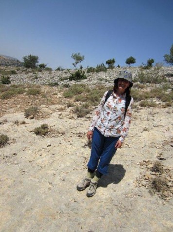
But then there’s a line in the trail guide, last on a list of bullet points, after the one telling you it’s a good idea to hire a guide: “We walk this trail every year, and there are no land mines. But off the trail…well…”
Actually, that’s paraphrasing, because I left my trail guide in Beirut. But you get the idea. I sure got the idea: If I were to wander off the trail, who knows what could happen? But I chose to squash down the fear of getting lost and losing my limbs and carry on. Squash, squash, squash.
Because Lebanon is crawling with hikers, all able-bodied, I figured the law of averages was on our side. But I figured it would be better to stick to better-traveled sections of trail, where the chance of getting lost was smaller. (Why didn’t we just hire a guide? you might ask. Well, Peter and I are skilled outdoorspeople who can read topo maps and a compass. But really: We’re introverts and really didn’t feel like chitchatting with a guide all day long.)
I also wanted the start and end points to be places that could be reached by public transport. But I wasn’t so self-sufficient that I wanted to carry camping gear.
The only section that satisfies all these needs–well-marked trail; guesthouses every night; accessible by bus–is legs 19, 20 and 21, between Barouk and Jezzine. A lot of it runs through the Chouf Cedar Reserve, for which there are additional, more current maps available (I picked these up at Antoine in Beirut). This gave me greater confidence in our decision not to hire a guide.
In fact, I got so cocky, I decided we should hike south to north, against the flow of the LMT guide, which describes the route north to south. This turned out to be the least of our worries.
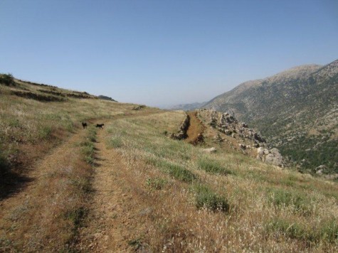
If you’re considering this hike, here are some details to know:
- Hiking south to north is fine. The trail guide is not so detailed that it’s hard to follow the other way. And there were several points on the route (especially hiking down from the Prophet Ayoub shrine to Niha) where we were glad we were going the opposite direction.
- On leg 21, hiking northbound, once you pass the mountain fort, be sure to stock up on water at the spring. Springs marked on the map farther along the trail were not actually springs–or we couldn’t find them. While you’re filling up your water bottles, consult your two maps–the LMT’s and the Chouf Reserve’s. See where they differ, and follow the Chouf Reserve’s. The LMT directs you through a canyon that is overgrown, and we couldn’t find the trail, and had to backtrack, cursing all the way.
- The guesthouse in Niha is great. The owner lost his hands to land mines. It’s unsettling, especially if you get lost on the way there, as we did (but you won’t, because you will have followed my advice above). He also works in the reserve cabin by the mountain fort, which you’ll pass on the way from Jezzine. This is convenient, if you’ve neglected to make reservations.
- From the Prophet Ayoub shrine down to Niha, there is indeed a trail, as the map suggests, though it’s not well marked at the top, and if you ask anyone, they’ll probably tell you it’s not there. It’s not super well maintained. But it is passable. Just head down through the picnic grounds and keep an eye out for trail blazes.
- Leaving Niha and heading north, the maps are contradictory, and the trail description isn’t clear. If you head back to where the shrine trail dumped you the day before, don’t cross the river, and at the first opportunity, scramble uphill a short distance to get to a trail running along the irrigation ditch you can see just up the hillside. Leave early in the day–once the trail heads uphill again, away from the irrigation ditch, it’s pretty grueling.
- We got lost in the last stretch before Maasser ech-Chouf, after Mristi. But we didn’t even realize it because we had convinced ourselves we were following trail blazes, but later realized they were no-trespassing or private-property symbols. The route we went wasn’t terrible, as it’s mostly through fields, and nothing overgrown. There’s another agricultural road a man in Mristi told us about, that goes from near the gas station on the far, far edge of town. Who knows where the real trail is. (Oh, yeah–a professional guide does.)
- The guesthouse in Maasser ech-Chouf is really lovely. The man who runs the shop and restaurant on the plaza is a smooth operator, and he’ll bring you more food than you order, and charge you for it all. But it’s good food, and it’s not expensive, and he’ll probably throw in invigorating herbal concoctions and coffee and sweets and funny hats to wear. Just think of it more as an all-you-can-eat-for-$15 place, rather than an a la carte restaurant.
- The trail north out of Maasser ech-Chouf (ie, south end of leg 19) is…I don’t know. Let’s just say not well marked. This is the one point where we definitely would’ve been happier with a guide. But we were so bent on leaving before the sun got hot that we didn’t want to wait for the guide to get into the office. We wound up scrabbling up a really steep mountainside and flopping out on the road, and having to hitch a ride to the Cedar Reserve entrance. It wasn’t pretty.
- There are no springs between Maasser ech-Chouf and Barouk. But the trail, after the uphill out of Maasser, isn’t strenous, and partially shaded. Plan accordingly.
- There are 800 vicious varieties of thistles in Lebanon. Plan accordingly, with thick socks or long pants.
- The guesthouse in Barouk needs to be booked at least two days in advance, said the owner on the phone, and it was so empty we were suspicious it’s ever open. Humph. But then we hopped a bus to Beiteddine, and walked to Deir al-Qamar, and finally found a hotel that wasn’t exorbitant. (But, it should be said, the owner was a bit appalled at our sweaty appearance–out of context of the hiking trail, we did look like filthy vagrants, by Lebanese uber-grooming standards. Keep this in mind if you plan extensive backpacking.)
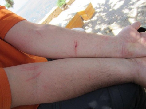
Did I mention land mines too much and scare you? I’m sorry–that shouldn’t have happened. The trail is land-mine-free!
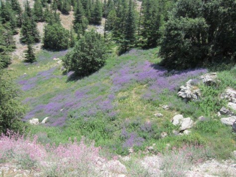
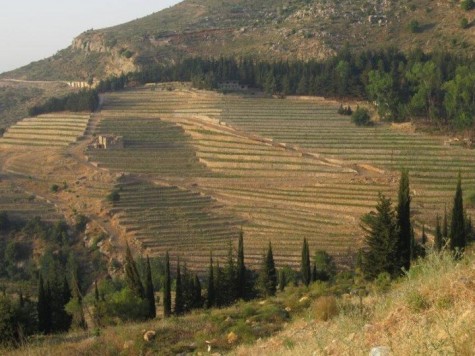
I loved hiking in Lebanon–we met nice people and saw millennia-old trees. I’d go back and do it again–I’d love to do some of the more northern legs especially. The Chouf is interesting terrain, and a nice mix of wild territory and farms.
And the efforts of the Lebanon Mountain Trail crew are admirable–it’s an excellent project, and I hope to take part in it again soon.
A good read and a good effort! Glad you made the point about ‘no guide’.Of course guides can be useful (and good company) but often experienced people just want to walk without help. Something not well understood by some Jordanian authorities. I must check the trail out sometime, it sounds good.
Dear Zora,
It is so nice to read an article about the LMT, in fact i am not sure if you ever visited the LMTA offices, however, maybe you did and i was not there,
I hope that you enjoyed your trip, thus, i am not sure how many days you walked and when was the dates, but please let me add some info:
On the LMT and around it, there are no landmines, the LMT was established between 2005 and 2007, the Association was created late 2007 and the trail plus the surrounding lands, that is for sure and there are no needs to mention that you may find some even if in the southern sections,
A guide, till now, is always recommended because of the lack of the LMT marks, (FYI, we are blazing all the sections, till now we marked 43km so far), also many stretches need to be each year cleaned like the ascent from Maaser square to the Cedar groove entrance, however anyone is free not to hire a guide and can buy the maps at the LMTA offices in Baabda, in this way you will find it easier to catch the springs :), you need always to contact the guesthouses before 48 hrs, especially for big groups, as also local guides are not always available because they work during weekdays,
i am sure the guide book need an update and needs more information,
Anyway, it is much needed to know and hear about hikers comments and ideas, they are always welcome,
Thank you for choosing the LMT as your hiking destination,
BTW, the last 2 lines are very impressive, we still have a long way to go, and one more thing, the LMT has been recommended on the list of the 10 great world map trails!
Best regards,
Christian Akhrass
LMTA field coordinator.
Thanks for reading, Tony! And glad you understand about the guide issue. I really deliberated about this–on the one hand, of course it’s great to meet a local, but it’s like layering too many things together in one day. I can handle the idea of a maybe two-hour guided nature walk–something focused like that.
Christian, thanks for the kind words–and sorry to dwell on the land-mine thing. It’s not very fair, I admit, and it’s great to have your comments here confirming that I was really just being unreasonably scared!
We only hiked three days–but we wanted to keep going! (That’s how we ended up walking to Deir al-Qamar–forward momentum, and beautiful scenery!) I really hope to make it back and do a longer trip…with a guide.
Thanks again for all your efforts!
Thank you Zora,
Your article/blog is already posted with pleasure on Lebanon Mountain Trail Association face book page, you can also “like” this page for more foll low up,
Best regards
Christian
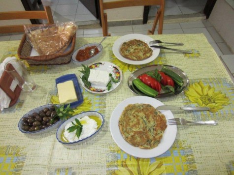
Can’t say I’ve ever heard of the Lebanon Mountain Trail but I can say with great confidence, it won’t be going on my list of places to visit. A) Hiking-eek! and b) Land Mines. No thanks. Speaking of landmines, Peter’s battle wounds look downright painless after the oft-mentioned landmines and the guy with no hands. But breakfast looks awesome. Welcome home.
If I didn’t already know you, Naomi, I’d try to hard-sell you on the hiking. I was exaggerating the land-mine panic for comedic effect, really! And excellent point about Peter’s “wounds” in proper perspective.
Dear Naomi,
NO LAND MINES on the LMT, this is definitive,
Zora, can you please update the article? readers are not understanding your comedic effect :), it will be a bad reputation for the 440km trek that we walk each year in April for 1 month, and hikers from all around the world is doing it every month,
Many thanks for your great efforts,
Chris.